It’s wild out there
When Ronald Serabia became a volunteer firefighter in 1967, incident reports were handwritten and stowed away in file cabinets. Now as a retired fire captain from the California Department of Forestry and Fire Protection, or CDF, he consults with first responders on ways a wireless network can be used to transmit such non-mission-critical data from Southern California’s rugged backcountry to state headquarters.
Serabia still volunteers as a CDF air tactical group supervisor. In this role, he flies an OB-10 Bronco — a ground-attack plane handed down to the department from the U.S. military — 100 feet above a fire scene to verbally control airborne water tankers extinguishing the fire. But he also is the liaison between first responders, who need wireless connectivity in the area’s remote regions, and researchers for the High Performance Wireless Research and Education Network, or HPWREN, who develop network applications.
HPWREN is a National Science Foundation-funded network research program developed in 2001 by Hans-Werner Braun, principal investigator at the San Diego Supercomputing Center, and Frank Vernon, co-principle investigator at the Scripps Institution of Oceanography. It is a non-commercial, prototype wide area network that spans from the Southern California coast to the area’s rugged mountain regions — which peak at 8700 feet above sea level. The longest link between network nodes stretches 72 miles.
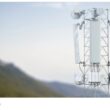
Backbone nodes are located at the University of California, San Diego, and San Diego State University campuses, Braun said. The backbone network operates primarily in licensed spectrum and delivers data rates of 45 Mb/s. Researchers use off-the-shelf technology to create a redundant topology.
“It’s basically a system integration of commercial, off-the-shelf radios,” Braun said. “The real research is more in quality of service and working with the applications with scientists, researchers, educators and first responders.”
Access links commonly use license-exempt radios, which Braun admits occasionally results in interference.
“[The analogy would be], if you have two people in a room yakking at the same time, it’s OK because you can hear each other,” he said. “But if you have 10 people, then you have interference.”
HPWREN originally was developed to support remote educational and scientific initiatives, said Frieder Seible, dean of the UCSD Jacobs School of Engineering. The university’s undergraduate and graduate engineering students work on parts of the network and develop applications as part of their studies.
Seible said several scientific disciplines currently tap into the network to transmit data from the field to the supercomputing center. For example, biologists use it to transmit data from solar-powered, acoustical sensors that monitor wolf behavior at the California Wolf Center, as well as from sensor-controlled, high-resolution cameras that record the activities of hawks in the state’s 4500-acre Santa Margarita Ecological Reserve.
Earth scientists also use the network to capture data from accelerometers that measure ground tremors during earthquakes in the upper Anza Borrego Desert north of Borrego Springs, Calif.
The Palomar Observatory is an astronomical research center in San Diego County that also uses HPWREN to share its discoveries with academic and scientific institutions worldwide. In fact, its applications are so intensive they currently are operating the network at full capacity. To address this bandwidth shortage, the backbone soon will be increased to deliver 200 Mb/s throughput from the current 45 Mb/s, said Braun, who added that the expansion still is at the research and development (R&D) stage.
To further support the aforementioned applications, Braun asked first responder agencies whether HPWREN could co-locate on their existing mountaintop facilities and repeater sites. Researchers’ antennas and other wireless technologies could be attached to existing towers in remote areas already armed with power and supplies, said Chris Hinshaw, manager of the wireless service division of the San Diego County Sheriff’s Department and the San Diego/Imperial County Regional Communications System.
In return, HPWREN scientists would oversee R&D for the department’s first responder communications. As part of the negotiation, whenever the department invests in new technology — be it 4.9 GHz radios or a network system — Braun volunteers his time to collect performance data and to provide statistics on how well the radios worked, including the distance at which they operate, their throughput and their error-checking capabilities. This is done at no cost to the department.
Hinshaw also noted that interference problems exist because some of the network’s systems operate in unlicensed spectrum, a situation Braun is beginning to address, he said.
“There’s a lot of interference issues, so he’s been slowly licensing the spectrum he uses for his connectivity,” Hinshaw said. “But as far as what he provides to us, we’re just grateful for anything he gives us.”
Working with first responders lets HPWREN researchers demonstrate how best to create and maintain wireless high-speed data connectivity in difficult circumstances, such as large-scale wildfires. This collaboration has led to multiple applications, such as the establishment of data connectivity at six incident command posts, Braun said. This capability lets first responders in the field send wildfire data to CDF headquarters in Sacramento in real-time.
Braun also pitched Internet access at pre-designated fire camps already established in the county’s backcountry that are prone to repeat fire incidents.
“With HPWREN providing a multi-bit per second data capability out to the fire camp, people could interact with their databases just like they were sitting at their desks,” Hinshaw said. “From out in the sticks, that is really valuable.”
The HPWREN team also worked with first responders to develop a system for CDF mobile command centers. When alerted about a fire incident, researchers armed with communications equipment deploy to the scene and connect antennas to mobile command vehicles. Relays already installed on mountaintops connect to the network backbone, and pre-positioned radios and additional antennas are used to establish connections in remote, rugged areas. This capability ultimately offers firefighters multi-bit per second connectivity to the Internet, Serabia said.
“We’ve had relays set up before the telephone company could get a regular phone line strung into the command post,” Serabia said about the U.S. Forest Service-led response to the Horse Fire, which burned nearly 17,000 acres of the Cleveland National Forest near San Diego over eight days in July 2006.
In addition to high-speed network access, incident command posts and permanent CDF fire camps also have access to real-time video, still camera images and meteorology sensor data. These systems support wireless alerts, Serabia said. For example, a network camera captured video data about the Horse Fire during the initial first-burning period — the first day of a wildfire, before it has a chance to burn aggressively. It transmitted 360° views of the area via the network back to the San Diego Supercomputing Center.
The meteorology sensors capture remote areas’ real-time weather data, such as wind speed, air temperature and relative humidity. Wind speed and weather data help officials determine the path of the fire.
Sensors installed in the same area record soil moisture levels to indicate the potential for a fire danger, Serabia said. When levels reach pre-set parameters, the sensors send a notice to the supercomputing center that then transmits an alert to a pre-designated list of firefighter pagers.
The network has become the model for an ambitious first responder communications project currently underway: the Communications Command and Control, or 3Cs, Network. It is a large-pipe, microwave data communications system funded by several public-safety and Department of Homeland Security grants, totaling more than $8 million dollars. When constructed, the system will deliver 155 Mb/s of data throughput, integrate voice over IP, video conferencing, real-time sensor telemetry and data integration, and connect all public-safety agencies in San Diego and Imperial counties. It also will provide access into Riverside and San Bernardino counties. Connectivity into Arizona is being negotiated, Hinshaw said.
“It will be a private/public safety intranet so we can share data on a network that’s safe, that’s secure, that’s redundant, that’s not dependent on a commercial network and is inexpensive compared to leasing T-1 lines,” he said. “We are utilizing what we learned from HPWREN. They are showing us how to do it, and we are emulating it.”