Starting small
Edge Wireless has become the first wireless telephone carrier on the West Coast to offer GPS-enabled phones for Phase II wireless E9-1-1 service.
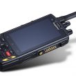
Nokia 5100, 6100, and 7100 series wireless phones used on the Edge Wireless system are fitted with an accessory that combines a battery and a GPS receiver. The GPS accessory sends location information to emergency service providers when users dial 9-1-1 and press the “Push-to-pinpoint” button. Location technology providers Airbiquity and Plant Equipment worked with Edge Wireless and the Oregon Office of Emergency Management to activate the service in Douglas County, OR, in April. Service to Josephine, Curry and Coos counties was slated to follow in June.
Responding to requests from carriers, including Edge Wireless, the FCC granted waivers to extend the Phase II deadline beyond the original Sept. 1, 2001, date. Edge Wireless perceived a marketing advantage, together with improved safety for its customers, and completed its Phase II installation not long after the original deadline. In its rural coverage area, Edge competes with Ramcell, U.S. Cellular, Sprint PCS and Nextel Communications to serve area residents, along with motorists on the busy Interstate 5 corridor.
“In this area, Edge Wireless has broken the ice,” said Herb Torrens, manager for corporate communications at Temecula, CA-based Plant Equipment. “When one carrier offers E9-1-1, the rest are motivated. A big reason to have a wireless phone is for safety. The first carrier to have it advertises and promotes it.”
Ken Keim, Oregon OEM’s section director for technology and response services, added that the four counties include a lot of land but a small population. The GPS accessory avoids the need to use technology installed at cell sites to triangulate, to measure time difference of arrival or to use other methods of calculating a handset’s location.
“We’re happy to get a Phase II installation working,” Keim said. “Plus, this installation gives us a way to prove the mapping technology that we’re going to use statewide.”
Using digital map information from Tele Atlas North America (formerly Etak), Menlo Park, CA, Keim’s team worked with employees at the Douglas County Sheriff’s Office Communications Center, a public safety answering point, to develop the master street address guide used to plot location coordinates delivered by wireless carriers. Torrens said that data often must be converted from old-fashioned tabular lists and paper maps to make the digitized map data sets used by a modern geographic information system for E9-1-1.
Plant Equipment’s mapping software matches coordinates sent by the GPS accessory over the Edge Wireless network to the PSAP with the nearest address in the street guide. A map pops up on the dispatcher’s screen showing the location and identifying it with an address, an intersection or a milepost. The dispatcher reads the information over a voice channel to the responder, unless the responder has a mobile data terminal.
“Edge Wireless brings the telephone call. Airbiquity brings us the latitude and longitude transmitted over the phone line and decodes it at the PSAP with the help of Plant Equipment’s mapping products. It took a lot of equipment and initiative to move this product along to get something out in the field and working,” Keim said.
Airbiquity, Bainbridge Island, WA, makes the GPS accessory for the Nokia handsets. The technology requires no modification of the handsets or the TDMA network used by Edge Wireless. Edge Wireless offers the GPS accessory pack for about $60 to $70 — much less than the cost of a stand-alone GPS unit and about the same price as a standard battery pack.
At the PSAP, Airbiquity’s aqServer and Plant Equipment’s Vesta (a telecommunications system that integrates computers and telephony) decode the GPS data. Plant Equipment’s digital mapping display, Orion MapStar, plots the precise location on the digital mapping display.
Keim said that the state has been working on a timeline since beginning to collect a tax in 1995 to fund wireless E9-1-1, and that the April launch of service in Douglas County was right on time. He said that the implementation might have happened sooner, but it took time to convert all the necessary maps to a digital form.
Keim said that more than 40% of calls to 9-1-1 in Oregon originate on wireless phones, and the percentage is rising. In the four-county area where Edge Wireless is rolling out Phase II service, he said that neither Ramcell Cellular nor U.S. Cellular has reached the level of Phase I service, which identifies which cell site is handling a wireless 9-1-1 call. He said that Sprint PCS and Nextel are in the process of installing Phase I service in the same area.
Andy Rimkus, vice president of marketing at Airbiquity, said the installation is important to the company as one of the first implementations of a GPS handset in the United States. He said that he anticipates that Edge Wireless would follow up with commercial services this year using the same product. Those services include operator-assisted, location-based services using location information that the customer would transmit voluntarily using the push button. Examples of commercial services include roadside assistance and help in finding the nearest bank or ATM.
“We’ve proven that there is a solution for TDMA and GSM systems,” Rimkus said. “Some have argued that such a solution doesn’t exist. I believe we’ve shown that it does.”
Moreover, Rimkus said that the installation is a “proof statement” to the public safety community and a credit to Edge Wireless’ leadership.
“Edge Wireless is a small rural carrier, and it has taken a big leadership role when other carriers perhaps have not. They showed that Phase II wireless E9-1-1 can happen today, where others seem to have taken a wait-and-see attitude toward wireless E9-1-1.”
Rimkus said that the Airbiquity GPS accessory would work the same with any of Edge Wireless’ competing carriers’ handsets.
Airbiquity has more rural carriers in its sights. Rimkus said that the FCC tracks 660 wireless carriers, leaving many potential carriers as customers beyond the “Big Six.”
“We are targeting those small-to-medium-size carriers that want to solve their 9-1-1 issues, and we have some more coming up,” he said. “We think rural carriers are underserved. GPS works well where you can’t triangulate easily, such as where cell towers are spread far apart. And a good number of rural carriers still use TDMA where usable Phase II technology is hard to come by.”
Bishop is editorial director. His email address is [email protected].
The players
Edge Wireless — An AT&T Wireless affiliate in the western United States, Edge Wireless has been operating in Oregon for less than a year. Jeff Keller, the company’s director of operations, noted that Edge Wireless’ competitors have been operating there for several years, without achieving Phase II wireless E9-1-1 service. Edge Wireless was formed in 1999 by Wayne Perry, Cal Cannon and Donnie Castleman. The company uses time-division, multiple-access network technology. Joe Gayer, director of strategic relations, heads the company’s wireless E9-1-1 team. Gayer has been an officer in state chapters of APCO and NENA.
Oregon OEM — By January 2001, the Oregon Office of Emergency Management had updated the state’s 57 PSAPs with integrated computer and telephony systems to deliver border-to-border wireline E9-1-1 service. In partnership with state chapters of APCO and NENA, Oregon’s 9-1-1 program includes a Phase II wireless location project that features statewide mapping services, an inter-tandem transfer network and database services.
Ken Keim, OEM section director of technology and response services, said that the state is ready to accept location data from carriers and to install the necessary interfaces in minimal time. “There’s a lot of frustration on my part and from the rest of the public safety community that carriers aren’t moving faster with Phase II,” he said. “When the Edge Wireless project came along, we jumped at it. We hope that with the successful completion of this installation, other carriers will be willing to step up and do something.”
Plant Equipment — Established in 1968, Plant Equipment made its first product, a key telephone system, for utility industry call centers. The company later developed automatic number identification and automatic location identification systems for 9-1-1 call centers. Today, the company offers an integrated management system for mapping components that allows call centers to build and customize digital master street address guides.
“We developed middleware for our mapping application, and Airbiquity’s aqServer that allows the two applications to exchange data, something we would do for any other location technology vendor. Our digital mapping display can accept wireless and wireline data from any type of system whether network- or handset-based,” said Herb Torrens, manager of corporate communications at Plant Equipment.
Airbiquity — A location technology company that delivers GPS data to wireless networks, Airbiquity sells patented aqLink software that enables wireless carriers, automobile manufacturers, commercial call centers and Internet portals to offer their subscribers location-based services that enhance productivity, manage assets and deliver personalized content. Among the company’s customers are AAA and its Response Services Center subsidiary, the Wingcast joint venture of Ford Motor and Qualcomm, Agere Systems (formerly Lucent Microelectronics) and Security Associates International.