https://urgentcomm.com/wp-content/themes/ucm_child/assets/images/logo/footer-logo.png
  • Home
  • News
  • Multimedia
    • Back
    • Multimedia
    • Video
    • Podcasts
    • Galleries
  • Commentary
    • Back
    • Commentary
    • Urgent Matters
    • View From The Top
    • All Things IWCE
    • Legal Matters
  • Resources
    • Back
    • Resources
    • Events
    • Webinars
    • White Papers
    • Reprints & Reuse
  • IWCE
    • Back
    • IWCE
    • Conference
    • Special Events
    • Exhibitor Listings
    • Premier Partners
    • Floor Plan
    • Exhibiting Information
    • Register for IWCE
  • About Us
    • Back
    • About Us
    • Contact Us
    • Advertisers
    • Terms of Service
    • Privacy Statement
    • Cookies Policy
  • Related Sites
    • Back
    • American City & County
    • IWCE
    • Light Reading
    • IOT World Today
    • Mission Critical Technologies
    • Microwave/RF
    • T&D World
    • TU-Auto
  • In the field
    • Back
    • In the field
    • Broadband Push-to-X
    • Internet of Things
    • Project 25
    • Public-Safety Broadband/FirstNet
    • Virtual/Augmented Reality
    • Land Mobile Radio
    • Long Term Evolution (LTE)
    • Applications
    • Drones/Robots
    • IoT/Smart X
    • Software
    • Subscriber Devices
    • Video
  • Call Center/Command
    • Back
    • Call Center/Command
    • Artificial Intelligence
    • NG911
    • Alerting Systems
    • Analytics
    • Dispatch/Call-taking
    • Incident Command/Situational Awareness
    • Tracking, Monitoring & Control
  • Network Tech
    • Back
    • Network Tech
    • Interoperability
    • LMR 100
    • LMR 200
    • Backhaul
    • Deployables
    • Power
    • Tower & Site
    • Wireless Networks
    • Coverage/Interference
    • Security
    • System Design
    • System Installation
    • System Operation
    • Test & Measurement
  • Operations
    • Back
    • Operations
    • Critical Infrastructure
    • Enterprise
    • Federal Government/Military
    • Public Safety
    • State & Local Government
    • Training
  • Regulations
    • Back
    • Regulations
    • Narrowbanding
    • T-Band
    • Rebanding
    • TV White Spaces
    • None
    • Funding
    • Policy
    • Regional Coordination
    • Standards
  • Organizations
    • Back
    • Organizations
    • AASHTO
    • APCO
    • DHS
    • DMR Association
    • ETA
    • EWA
    • FCC
    • IWCE
    • NASEMSO
    • NATE
    • NXDN Forum
    • NENA
    • NIST/PSCR
    • NPSTC
    • NTIA/FirstNet
    • P25 TIG
    • TETRA + CCA
    • UTC
Urgent Communications
  • NEWSLETTER
  • Home
  • News
  • Multimedia
    • Back
    • Video
    • Podcasts
    • Galleries
  • Commentary
    • Back
    • All Things IWCE
    • Urgent Matters
    • View From The Top
    • Legal Matters
  • Resources
    • Back
    • Events
    • Webinars
    • White Papers
    • Reprints & Reuse
    • UC eZines
  • IWCE
    • Back
    • Conference
    • Special Events
    • Exhibitor Listings
    • Floor Plan
    • Exhibiting Information
    • Register for IWCE
  • About Us
    • Back
    • About Us
    • Contact Us
    • Advertise
    • Terms of Service
    • Privacy Statement
    • Cookies Policy
  • Related Sites
    • Back
    • American City & County
    • IWCE
    • Light Reading
    • IOT World Today
    • Mission Critical Technologies
    • Microwave/RF
    • T&D World
    • TU-Auto
  • newsletter
  • In the field
    • Back
    • Internet of Things
    • Broadband Push-to-X
    • Project 25
    • Public-Safety Broadband/FirstNet
    • Virtual/Augmented Reality
    • Land Mobile Radio
    • Long Term Evolution (LTE)
    • Applications
    • Drones/Robots
    • IoT/Smart X
    • Software
    • Subscriber Devices
    • Video
  • Call Center/Command
    • Back
    • Artificial Intelligence
    • NG911
    • Alerting Systems
    • Analytics
    • Dispatch/Call-taking
    • Incident Command/Situational Awareness
    • Tracking, Monitoring & Control
  • Network Tech
    • Back
    • Cybersecurity
    • Interoperability
    • LMR 100
    • LMR 200
    • Backhaul
    • Deployables
    • Power
    • Tower & Site
    • Wireless Networks
    • Coverage/Interference
    • Security
    • System Design
    • System Installation
    • System Operation
    • Test & Measurement
  • Operations
    • Back
    • Critical Infrastructure
    • Enterprise
    • Federal Government/Military
    • Public Safety
    • State & Local Government
    • Training
  • Regulations
    • Back
    • Narrowbanding
    • T-Band
    • Rebanding
    • TV White Spaces
    • None
    • Funding
    • Policy
    • Regional Coordination
    • Standards
  • Organizations
    • Back
    • AASHTO
    • APCO
    • DHS
    • DMR Association
    • ETA
    • EWA
    • FCC
    • IWCE
    • NASEMSO
    • NATE
    • NXDN Forum
    • NENA
    • NIST/PSCR
    • NPSTC
    • NTIA/FirstNet
    • P25 TIG
    • TETRA + CCA
    • UTC
acc.com

View From The Top


Commentary

How 3D location can increase situational awareness and improve operational efficiency

How 3D location can increase situational awareness and improve operational efficiency

  • Written by Amir Sattar
  • 29th March 2019

Public-safety responders put their lives on the line every day to protect citizens from threats of all kinds. For most of us, this dedication and effort is taken for granted, as it goes largely unseen. This is because police and fire departments—and other first-responder agencies—are committed to being responsive in emergency situations while ensuring that citizens continue to enjoy the freedoms of living in an open and accessible environment.

This openness is put under the most stress during large public events. These require detailed planning and the optimal deployment of resources and personnel to ensure that, in an emergency, help gets to the people that most need it as quickly as possible. Fortunately, increasingly sophisticated technologies have been introduced to assist public-safety organizations in their efforts.

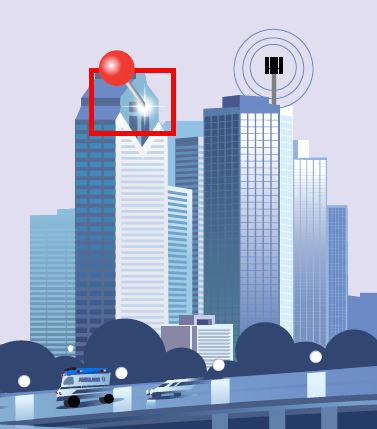
One of these is three-dimensional (3D) location, which can locate a wireless device on both the horizontal and vertical planes. 3D location provides first responders with increased situational awareness, by continuously monitoring an environment and pinpointing the originating location of emergency calls, and with better operational efficiency, by dispatching the nearest team with the proper equipment to reach those in need of help. Enhanced location accuracy and quicker responses have been proven to save lives.

The following notional use case of a city’s management of a downtown parade illustrates how situational awareness based on accurate 3D location can improve operational efficiency, reduce costs, and help save lives.

Problem: How to improve emergency response times during a city parade

A major city’s coordinated public-safety efforts—involving police, fire, and EMS—had been challenged every year during the city’s Independence Day parade and street fair. The event attracted tens of thousands of attendees to the two-mile-long parade route and nearby block parties.

Public-safety agencies were challenged by the large numbers of people, limited street access for emergency vehicles, and the use of high-rise buildings as viewing points along the route. In order to maintain safety and ensure that they were able to respond quickly to emergencies wherever they occurred, agencies ended up overstaffing the event, staging field teams throughout the area.

Despite dedicating these resources, response times to incidents lagged. Two key reasons: agencies did not have a real-time view of exactly where their teams were located, and emergency calls from high-rise buildings did not identify the floor number, unless it was provided by the caller.

“During the annual Fourth of July parade, my team is under increased pressure to make sure people stay safe,” according to the city’s public-safety director. “We do a good job in crowd control and in identifying threats before they become a problem, but we can only do this by flooding the streets with officers, which isn’t very efficient and—event then—doesn’t solve the problem of how to get the right officers to the people who need them most.

“Our response times lagged year over year, and we particularly had an issue in getting to people who hold viewing parties in the high-rise condo and office buildings along the parade route. When a 911 call comes in from one of those locations, we don’t always know what floor to go to, and callers can’t always identify their exact location, since many of them are visiting and are unfamiliar with the area or—more importantly—may be incapacitated due to a medical emergency and unable to provide locations specifics, such as apartment or suite number in a multi-story building.

“After a few highly-publicized incidents of not being able to reach people in time who needed help, we realized we needed a new approach.”

Solution: 3D location

The public-safety agencies were able to solve their problem by deploying a real-time situational-awareness and communication solution with high accuracy 3D location via a downloadable application into the department’s mobile devices. The technology pinpoints location on three dimensions by utilizing all available signals and sensor measurements, such as cellular, Wi-Fi, GPS, barometric sensor data, and motion sensors from nearby buildings and the device itself.

With this capability in place, emergency field teams are now able to be located with high accuracy throughout the area, even in high-rise buildings. At the first-response command center, police, fire, and EMT resources are all visible on a map and are connected to each other via a push-to-talk, instant-communications capability. Assuming the wireless operator has deployed vertical-location capability into its network, when an emergency call comes in to the public-safety answering point (PSAP), the caller’s exact location—including floor level—is easily determined.

The first responders in closest proximity are dispatched, shaving seconds and, sometimes, even minutes off the response times, which can mean the difference between life and death, in some cases. 3D location provides increased situational awareness, so agencies can identify issues and quickly move resources into place.

With 3D location, the agencies can rightsize their staffing requirements on parade day, resulting in reduced costs and better operational efficiency. This has enabled them to redirect these budget savings toward newer equipment and proactive help stations for non-emergency situations, such as minor injuries, lost children and traffic incidents.

The enhanced capabilities and better visibility won plaudits from the city.

“We are very happy with how 3D location has made our job of being responsive to, and protecting and serving the public much easier,” the director stated. “Instead of placing field teams everywhere and anywhere, I can more strategically assign personnel where my data has shown they are most likely to be needed and have the confidence that I can quickly reposition them in real time, if the need arises, because I know the exact 3D location of both the caller and first responders.

“The biggest impact has been in the deployment of the closest nearby teams to high-rise buildings. It’s amazing to watch on a 3D map as my team ascends an elevator en route to an emergency call. We have had a significant reduction in the percentage of emergency calls where first responders went to the wrong address. The improved 3D-positioning awareness has allowed us to do what we do best—respond expediently to emergency calls, provide help, and save lives. We look forward to utilizing 3D location to assist in other upcoming events.”

This city’s experience is not unique. As more public-safety organizations take advantage of new technology to locate their own personnel and people who rely on them for help, response times are going down. and the number of successful outcomes and lives being saved is going up—all thanks to real-time, high-accuracy 3D location.

Amir Sattar is vice president of Polaris Wireless, a provider of software-based wireless location solutions.


Tags: homepage-featured-4 Applications Commentary Commentary Newsletters Critical Infrastructure Dispatch/Call-taking Enterprise Federal Government/Military Funding In-Building Incident Command/Situational Awareness IoT/Smart X Networks & Systems Commentary NG-911 PSAP Commentary Public Safety Public Safety Commentary Public-Safety Broadband/FirstNet Software State & Local Government Subscriber Devices System Operation Tracking, Monitoring & Control Wireless Networks View From The Top Commentary

Related


  • Newscan: Sheriff Neil Miller of Buffalo County, Neb., receives prestigious McEwen Award from FirstNet Authority
    Newscan: Sheriff Neil Miller of Buffalo County, Neb., receives prestigious McEwen Award from FirstNet Authority
    Web Roundup Items from other news organizations Schools spy on kids to prevent shootings, but there’s no evidence it works Huawei sues the FCC, ramping up fight with critics and foes Pennsylvania health system files lawsuit against Nuance over malware attack Nebraska Medicine alerts patients of data breach How streetlight data uses machine learning to […]
  • Upcoming Band 14 PTT devices ‘phenomenal,’ FirstNet Authority board member says
    Not-yet-available push-to-talk LTE devices that are being evaluated in the FirstNet Authority laboratory should please public-safety users and are “getting very, very close” to the type of solutions first responders would want to replace land-mobile-radio (LMR) handsets, a FirstNet Authority board member said today. Neil Cox, chairman of the FirstNet Authority board’s Network and Technology […]
  • Commerce Department vet Lisa Casias named as Deputy CEO for the FirstNet Authority
    U.S. Department of Commerce veteran Lisa Casias was announced as the new Deputy CEO for the FirstNet Authority during yesterday’s open meeting of the organization’s board members. FirstNet Authority board Chairman Ed Horowitz introduced Casias as a “recent addition to our leadership team,” noting that she comes to the FirstNet Authority from the U.S. Department […]
  • Newscan: FCC Chairman Ajit Pai calls on Congress to protect public safety and repeal T-Band mandate
    Newscan: FCC Chairman Ajit Pai calls on Congress to protect public safety and repeal T-Band mandate
    Web Roundup Items from other news organizations No end in sight for FirstNet interoperability debate Tech aims to predict problems on power lines for disaster Recordings show stroke victim in Chicago called 911 but couldn’t get help without address In coded 911 call, Ohio woman requested the police by ordering a pizza Virginia boosts funding […]

Leave a comment Cancel reply

To leave a comment login with your Urgent Comms account:

Log in with your Urgent Comms account

Or alternatively provide your name, email address below:

Your email address will not be published. Required fields are marked *

Related Content

  • Newscan: ‘Spending like the Jetsons, living like the Flintstones’—the trouble with smart-city 5G
  • Group announces successful test of multi-vendor MCPTT call with end-to-end security
  • Pyramid Consulting Services: Terry Burnworth outlines 911 information-overload challenges, previews Dec. 11 webinar
  • Sierra Wireless launches AirLink Managed Network Service offering with FirstNet connectivity

Commentary


T-Mobile proposal of free 5G for public safety is a great idea, but there are a lot of caveats

15th November 2019

911 dispatch centers can take multiple steps to combat cyberattacks

15th November 2019

Proposed three-digit suicide-prevention ‘Lifeline’ would benefit public-safety communications

  • 1
4th October 2019
view all

Events


UC Ezines


IWCE 2019 Wrap Up

13th May 2019
view all

Twitter


UrgentComm

The @FirstNetGov labs are evaluating not yet available #PPT #LTE devices. Firstnet Authority board members say thes… twitter.com/i/web/status/1…

11th December 2019
UrgentComm

Our last #PTT and #futureofvoice webinar is tomorrow! Join us for the "Decision time: Balancing Investments in MCP… twitter.com/i/web/status/1…

11th December 2019
UrgentComm

The CEO of @MotoSolutions said that FirstNet LTE is complementary to #LMR in response to their introduction of the… twitter.com/i/web/status/1…

10th December 2019
UrgentComm

Don't miss the "Next Generation Dispatching - What is the Future of Dispatch?" webinar on Dec 11 at 2 PM ET. Our ex… twitter.com/i/web/status/1…

10th December 2019
UrgentComm

At OCR2019, Michael Quiroga, @flyasylon's chief revenue officer demos how their autonomous drone service includes a… twitter.com/i/web/status/1…

10th December 2019
UrgentComm

Terry Burnworth, president of @Pyramid_ACE1 explains the challenges that #911centers face as transitions from voice… twitter.com/i/web/status/1…

9th December 2019
UrgentComm

President and co-founder of @FLYMOTIONmedia demonstrates the ability of the company's drone service to provide trad… twitter.com/i/web/status/1…

9th December 2019
UrgentComm

Ioan Pop describes the features of a durable security-enhancement robot prototype call Roameo that can be customize… twitter.com/i/web/status/1…

9th December 2019

Newsletter

Sign up for UrgentComm’s newsletters to receive regular news and information updates about Communications and Technology.

Expert Commentary

Learn from experts about the latest technology in automation, machine-learning, big data and cybersecurity.

Business Media

Find the latest videos and media from the market leaders.

Media Kit and Advertising

Want to reach our digital and print audiences? Learn more here.

DISCOVER MORE FROM INFORMA TECH

  • American City & County
  • IWCE
  • Light Reading
  • IOT World Today
  • Mission Critical Technologies
  • Microwave/RF
  • T&D World
  • TU-Auto

WORKING WITH US

  • About Us
  • Contact Us
  • Events
  • Careers

FOLLOW Urgent Comms ON SOCIAL

  • Cookies Policy
  • Privacy
  • Terms
Copyright ©2019 Informa PLC. Informa Telecoms & Media Limited is a company registered in England and Wales with company number 00991704 whose registered office is 5 Howick Place, London, SW1P 1WG. VAT GB365462636. Informa Telecoms & Media Limited is part of Informa PLC.
Websites are now required by law to gain your consent before applying cookies. We use cookies to improve your browsing experience. Parts of the website may not work as expected without them. By closing or ignoring this message, you are consenting to our use of cookies.
X